How to Buy Satellite Imagery for Any Location: A Practical Buyer’s Guide
Start with the decision you need to make, then choose coverage, dates, resolution and usage rights. This guide turns a location into a useful satellite data request.
 View full-size image ↗
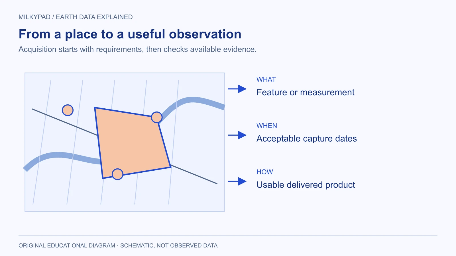
Buying satellite imagery starts with a question about a place, not a satellite name. Define what you need to detect or measure, where the answer matters, and when the observation must have been made. Those three decisions narrow the available data much more effectively than asking for the highest possible resolution.
You can request data for any location, but a suitable image is not guaranteed to exist for every date, sensor or specification. A sensible purchasing process checks existing data first, tests whether it answers the question, and commissions a new collection only when necessary. This guide explains that process for people buying imagery for the first time.
Translate the business question into an observation
“Show me this property” is different from “measure how much vegetation changed on this property.” The first might need a recent visual image. The second needs comparable observations, appropriate spectral bands, and a defensible measurement method. A beautiful picture can be the wrong scientific input.
Write one sentence describing the decision the image will support. For example: “We need to identify which parts of the proposed site deserve a field inspection before the next planning meeting.” Then write what evidence would change that decision. This prevents buying detail that has no practical use and makes discussions with a supplier more productive.
Separate the desired output from the input. A boundary map, a vegetation summary and a change alert are outputs. Satellite scenes, elevation rasters and spectral measurements are inputs. Ask who will convert one into the other, because acquisition alone does not include every analysis or interpretation task.
Draw the area that matters
An area of interest, usually shortened to AOI, is the geographic footprint of the request. A point or street address is useful for finding a location, but a polygon shows the actual land, coastline or corridor that needs coverage. Include relevant surroundings when the question depends on them. Drainage, access routes and neighboring development rarely stop at an ownership boundary.
Check the polygon against a familiar map before submitting it. Look for reversed coordinates, missing islands, unintended holes and excessively broad bounding rectangles. GeoJSON, a common format for exchanging AOIs, lists longitude before latitude (RFC 7946), so a file that swaps them puts the polygon somewhere else entirely. A narrow road corridor and the rectangle surrounding it can represent very different purchase areas. Ask whether billing follows your polygon, a minimum area, or complete image scenes.
Collection constraints are product specific. Minimum areas, accepted shapes and coverage rules differ from one collection to the next, so treat a global coverage statement as a starting point for feasibility, not confirmation that your exact order will be fulfilled. When you ask for a price, send the drawn polygon rather than an address and ask for the billable area in the reply.
Decide how recent the image must be
Choose an acceptable acquisition window rather than writing “latest.” If you are preparing a land-cover baseline, a suitable image from the same season last year may be more useful than yesterday’s cloudy observation. If you need evidence after a specific event, an image taken before the event is unsuitable however recently it appeared in a catalog.
Record the event date, earliest acceptable capture, latest acceptable capture and deadline for receiving a usable product. These are separate constraints. A supplier may be able to collect within your window but require additional time for processing and delivery. Ask what happens if no acceptable observation is obtained.
Search the archive before requesting a new capture
Archived imagery has already been collected. Tasking asks a provider to make a future observation. Commercial catalogs usually offer both kinds of acquisition, while availability and order terms depend on the selected product. Open data programs are worth a first look: the free Copernicus Browser searches Sentinel imagery by place, date and cloud cover, and the historical satellite imagery page explains how far back each archive goes. The practical comparison is whether an existing observation meets the brief, not whether one route sounds more advanced.
Review candidate scenes over the actual AOI. Check date, usable coverage, cloud or haze, shadows and viewing geometry. Preview images help reject obvious problems, but ask for product specifications and sample data when measurements matter. A display preview does not prove that all required analytical bands are included in the purchased package.
If the archive is unsuitable, specify which constraint failed. “No image within our date window” points toward tasking. “Buildings are too small to distinguish” points toward a different resolution. “We need a temperature measurement” points toward a different sensor or product. Tasking the wrong instrument does not repair an incorrect specification.
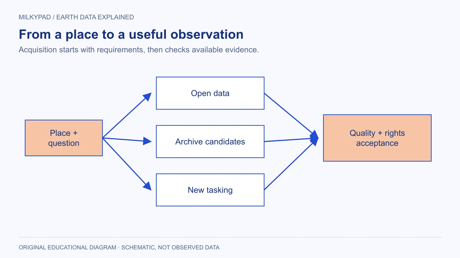
The branches represent alternative acquisition routes. Every route still ends with a quality and usage-rights check.
Request the product you can actually use
Ask for the native spatial resolution, included bands, processing level, coordinate reference system and file format. Explain whether the result will be inspected visually, analyzed numerically, loaded into a GIS application or published in an app. These destinations affect the appropriate delivery.
For analysis, retain metadata and quality information alongside the imagery. For a public-facing map, clarify whether you need a licensed display service, downloadable files or derived results. Avoid assuming that receiving a file grants permission to distribute that file to customers. State your audience and sharing plans before comparing prices.
| Decision | Write this in your request | Why it matters |
|---|---|---|
| Purpose | The feature or change you need to identify | Determines suitable data |
| Geography | Checked AOI polygon and useful surroundings | Establishes coverage |
| Time | Capture window and delivery deadline | Separates recency from availability |
| Quality | Acceptable clouds, shadows and missing coverage | Makes acceptance review possible |
| Delivery | Analytical files, metadata and intended software | Prevents unusable packages |
| Rights | Internal users, clients or public application | Aligns the license with the project |
Worked example: a hypothetical inspection project
Imagine a small engineering company evaluating three proposed logistics sites. The team wants to identify substantial new construction and obvious access changes before visiting. It does not need to identify individual people, inspect roof defects or certify property boundaries. Those tasks would require different evidence and may be inappropriate for satellite imagery.
The team draws each site with a surrounding access corridor, chooses a recent capture window, and asks for an older comparison image from a similar season. It requests enough visual detail to distinguish the changes relevant to an inspection shortlist. The supplier returns several archive candidates, including one with a cloud shadow crossing the entrance road.
Instead of accepting a low whole-scene cloud percentage, the team rejects that candidate because the obscured entrance is the critical feature. Another site has a suitable recent image but an older baseline with a very different viewing angle. The team records the comparison limitation and decides that a field visit must settle ambiguous changes. It tasks only the remaining site for which no acceptable archive exists.
This is a hypothetical workflow, not a Milkypad customer result or a guarantee of collection. Its useful lesson is that acceptance criteria can change the buying decision more than a headline resolution or unit price.
Review the delivery against the brief
Before closing the purchase, compare delivered capture times and footprints with the agreed request. Open representative files, inspect the important locations, and confirm that metadata identifies the sensor, processing and coordinate system. Check that all files open in the software your team intends to use. A successful download is only a transport check.
Keep a short acceptance record listing what passed, what remains uncertain and who approved the product. If the imagery supports a consequential decision, record independent evidence as well. Satellite observations can narrow questions for field inspection; they do not automatically establish legal ownership, structural safety or the cause of a visible change.
Milkypad’s data acquisition approach focuses on connecting requirements with suitable Earth data. To get options and a price, send the location, observation question and date window when you ask for a price; Milkypad replies within one business day. A clear brief is useful even when the eventual answer is that existing open data already meets your needs.
Further reading
- How to choose satellite imagery for your task — Milkypad.
- Satellite image resolution explained — Milkypad.
- Copernicus Browser documentation — Copernicus Data Space Ecosystem.
- RFC 7946: The GeoJSON Format — IETF.
Sources checked on 14 and 23 October 2026.
Sources checked 2026-10-23. Illustrations created by Milkypad. Diagrams and numerical teaching examples are schematic unless explicitly identified otherwise.